Azure Maps for Azure IoT Services
Blog|by Mary Branscombe|19 March 2021

Don’t think of mapping services as traffic and roads and directions; think of them as a way to represent objects and relationships in the physical world, and geolocation and spatial analysis become extremely relevant to the Internet of Things (IoT).
The emphasis in IoT is often on the things themselves: the sensors they contain and how to collect, store and use the data they generate. Microsoft has just announced its acquisition of The Marsden Group to help customers create industrial IoT prototypes. But given that those sensors become the digital interface to the physical world, knowing where they’re placed and understanding what’s around them can be key to a successful deployment.
That’s why when Microsoft created the Azure Maps geospatial platform to deliver enterprise location services on Azure, even though one of the key projects was going to be Microsoft’s Connected Vehicle Platform, the Maps team were actually part of Azure IoT. As the service developed, it was clear that maps and location would be an important part of smart environments, from industrial digital twins and autonomous systems to connected buildings and smart cities.
Azure Maps Geocoding service
Knowing where your asset is, is helpful for asset management and Azure Maps offers a geocoding service that converts addresses into latitude and longitude, as well as a timezone series that’s helpful for scheduling maintenance in facilities across different regions or countries. The timezone series can also report which country IP addresses are in.
But beyond having accurate records, location can also be important in modelling and predictive maintenance for gaining insight and making data-driven decisions, as can location-related services like weather (which includes air quality), transit planning and route-finding even when spatial analysis isn’t your main goal.
Watch the recording of our Azure Maps webinar, The Location of Things: Smart Cities with Azure Maps, IoT and Digital Twins. Link to the recording on our YouTube channel here
Azure Maps for geospatial context

Knowing that a room thermostat is next to a heater or a moisture sensor is close to an open window on a rainy day allows you to interpret readings much more accurately. If you put light, temperature and humidity sensors in a truck used for shipping food, knowing the location of the truck at the time of any unusual readings can help you understand whether the refrigeration unit is faulty or the doors have been opened for an inspection at a checkpoint (but, say, the cloud cover is so heavy that the light sensor isn’t triggered).
You may also want to factor location into higher level decisions, like taking into account where qualified staff or critical parts are, when prioritising warnings from predictive maintenance systems and deciding which to service first.
From managing, monitoring and maintaining IoT devices to building data models from sensor readings, the geospatial context – whether it’s their absolute physical location or where they are in relation to people and other things – turns out to be really important.
Understanding Azure IoT Services
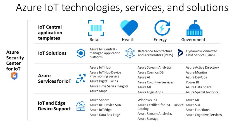
Microsoft has multiple managed cloud services for connecting, monitoring, controlling and analysing the data from IoT assets, grouped together under the Azure IoT umbrella.
Azure Sphere is a solution for secure IoT devices using certified microcontrollers with a hardware root of trust, a secure OS and a security service that monitors communications between devices and the cloud or device to device.

Azure Time Series Insights is for storying and querying the large amounts of time series data emitted by sensors to turn that into insights you can take action on.
Azure IoT Hub enables bi-directional communications between cloud and devices, so you can collect sensor readings from a device and send back control signals to turn the device up or down. It includes a device provisioning service for rolling out large numbers of IoT devices securely and there are SDKs for building your own IoT solution.
Azure IoT Edge is built on IoT Hub, letting you move some of the analysis or control workload directly to the edge device where latency or bandwidth means that gives a better experience.
Azure IoT Central is a managed IoT application platform with industry-specific templates and solution accelerators to simplify building an enterprise IoT solution. There’s a web UI for managing certified devices – including seeing their location, monitoring device conditions and creating rules that respond to sensor reading (which you can extend programmatically and integrate with other applications using APIs).

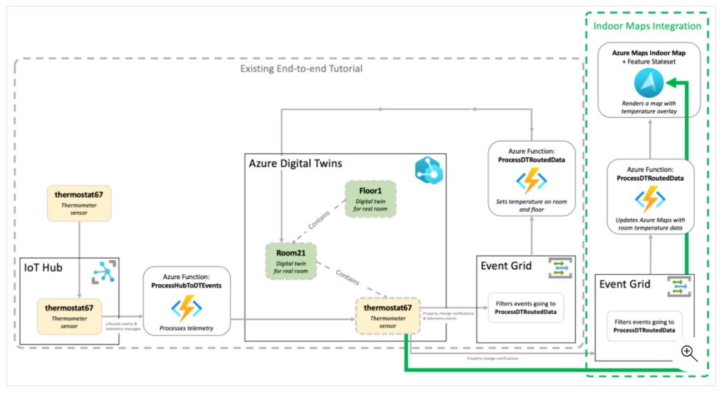
It’s easy to see the way having these different services available is useful for devices that move around. Geofencing an area on a map and ingesting telemetry from vehicles – whether that’s a car, truck, scooter, drone or or a forklift truck inside a warehouse – through Azure IoT Hub and Azure Event Grid lets you trigger an Azure Function to show the location on a map in an app or a Power BI dashboard, send a delivery estimate or put the details into Azure Blob Storage for later time series analysis with Azure Stream Analytics.
Combining the location and time series data makes it easy to incorporate geolocated information like weather or air quality conditions into the analysis because the reference for getting that information is included in the data logged from the IoT device.
But spatial information is also useful within a location; take optimising the way items are stored in a warehouse or depot. Having a 2D map of where different components or packages are located that is accurate, up to date and connected live to your ERP system can speed up pulling orders or making repairs. But 3D information and details like elevation take it to the next level, because the aisles in a warehouse typically store things on multiple levels and those shelves usually have different capacities and may also have weight limits. So to optimise the warehouse so that the right boxes are in the right location at the right time to fill in a truck in the right order for the different deliveries it’s going to make on its next run, you need to consider the shape and size of boxes as well as the contents, not just the layout of the building.
When you look beyond maps and directions and reference information, location becomes a key part of the schema and ontologies for working with almost everything in the physical world, making Azure IoT the logical home for Azure Maps.
Grey Matter is an Azure specialist. Our accredited teams work across Azure Maps, Azure Services, Azure IoT. Contact the Azure Maps team directly. They can organise a scoping call with our other Azure teams to discuss your use case if required, they can also confirm Proof of Concept availability.
Contact Grey Matter
If you have any questions or want some extra information, complete the form below and one of the team will be in touch ASAP. If you have a specific use case, please let us know and we'll help you find the right solution faster.
By submitting this form you are agreeing to our Privacy Policy and Website Terms of Use.
Mary Branscombe
Mary Branscombe is a freelance tech journalist. Mary has been a technology writer for nearly two decades, covering everything from early versions of Windows and Office to the first smartphones, the arrival of the web and most things in between.
Related News
A summary of our time at ESET World
To help you stay up to date on the latest security trends and product updates, it’s important for us to stay in the know. We like keep you well informed of trends, important industry changes and key products that might...
Solving your logistics challenges with AI and real-time data
Looking to optimise your logistics with AI and real-time data? Tune in to our latest episode of our new podcast, Grey Matter Talks Tech. In this episode, our mapping expert Sam Avery and Microsoft Maps Sr. Program Manager Clemens Schotte,...
News speakers announced for Embarcadero event
Your chance to network with the Delphi expert We’re delighted to announce that Embarcadero’s Delphi guru Marco Cantù will be joining on 7 May in London at our Embarcadero developer conference. You’ll get the chance to hear first-hand what’s new...
Celebrating World Backup Day: Protect your business data
31 March marks World Backup Day – a day dedicated to raising awareness about the importance of data protection and backup In today’s digital age, safeguarding your business data is more crucial than ever. This day is not just about...